
Wau topographic map
Interactive map
Click on the map to display elevation.
About this map
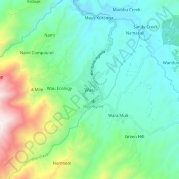
Name: Wau topographic map, elevation, terrain.
Location: Wau, Morobe, Momase Region, 561, Papua New Guinea (-7.38031 146.67727 -7.30031 146.75727)
Average elevation: 1,252 m
Minimum elevation: 870 m
Maximum elevation: 2,359 m
Other topographic maps
Click on a map to view its topography, its elevation and its terrain.