
Donghol Nyamakou topographic map
Interactive map
Click on the map to display elevation.
About this map
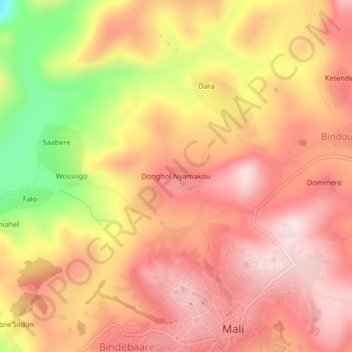
Name: Donghol Nyamakou topographic map, elevation, terrain.
Location: Donghol Nyamakou, Mali, Mali Prefecture, Labé Region, Guinea (12.07291 -12.32234 12.11291 -12.28234)
Average elevation: 1,355 m
Minimum elevation: 1,106 m
Maximum elevation: 1,488 m