
La Villeneuve topographic map
Interactive map
Click on the map to display elevation.
About this map
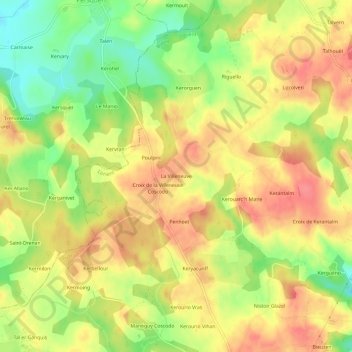
Name: La Villeneuve topographic map, elevation, terrain.
Average elevation: 150 m
Minimum elevation: 110 m
Maximum elevation: 178 m
Other topographic maps
Click on a map to view its topography, its elevation and its terrain.
Saint-Yves
France > Bretagne > Morbihan > Bubry > Saint-Yves
Saint-Yves, Bubry, Lorient, Morbihan, Bretagne, France métropolitaine, 56310, France
Average elevation: 121 m
Toulbouillen
France > Bretagne > Morbihan > Bubry
Toulbouillen, Bubry, Lorient, Morbihan, Bretagne, France métropolitaine, 56310, France
Average elevation: 130 m
La Madeleine
France > Bretagne > Morbihan > Bubry
La Madeleine, Bubry, Lorient, Morbihan, Bretagne, France métropolitaine, 56310, France
Average elevation: 131 m