Geolocate

West Bergholt topographic map

Interactive map

Click on the map to display elevation.

About this map

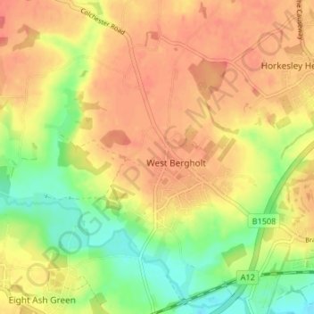
Name: West Bergholt topographic map, elevation, terrain.

Location: West Bergholt, Colchester, Essex, England, United Kingdom (51.89661 0.81300 51.93758 0.87213)

Average elevation: 41 m

Minimum elevation: 7 m

Maximum elevation: 64 m

Routes: England GPS tracks, routes, trails, hikes

Other topographic maps

Click on a map to view its topography, its elevation and its terrain.

Great Tey

United Kingdom > England > Colchester

Average elevation: 51 m

Copford

United Kingdom > England > Colchester

Average elevation: 36 m

Tiptree

United Kingdom > England > Colchester

Average elevation: 53 m

Wivenhoe

United Kingdom > England > Colchester

Average elevation: 22 m

Langenhoe

United Kingdom > England > Colchester

Average elevation: 11 m

Layer Marney

United Kingdom > England > Colchester

Average elevation: 39 m