
Arcy topographic map
Interactive map
Click on the map to display elevation.
About this map
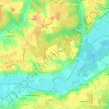
Name: Arcy topographic map, elevation, terrain.
Average elevation: 191 m
Minimum elevation: 173 m
Maximum elevation: 208 m
Other topographic maps
Click on a map to view its topography, its elevation and its terrain.
Les Pilloux
France > Bourgogne-Franche-Comté > Saône-et-Loire > Savigny-sur-Seille > Les Pilloux
Les Pilloux, Savigny-sur-Seille, Louhans, Saône-et-Loire, Bourgogne-Franche-Comté, France métropolitaine, 71440, France
Average elevation: 196 m