
Thank you for supporting this site ❤️
Make a donation
Make a donation
Gear up for your next adventure:
As an Amazon Associate, this site earns from qualifying purchases at no extra cost to you.
Dabel topographic map
Click on the map to display elevation.
Thank you for supporting this site ❤️
Make a donation
Make a donation
Gear up for your next adventure:
As an Amazon Associate, this site earns from qualifying purchases at no extra cost to you.
About this map
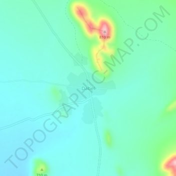
Name: Dabel topographic map, elevation, terrain.
Location: Dabel, Golobo ward, Moyale, Marsabit County, Eastern, Kenya (3.13165 39.23105 3.17165 39.27105)
Average elevation: 654 m
Minimum elevation: 615 m
Maximum elevation: 817 m
Thank you for supporting this site ❤️
Make a donation
Make a donation
Gear up for your next adventure:
As an Amazon Associate, this site earns from qualifying purchases at no extra cost to you.