
兴城市 topographic map
Interactive map
Click on the map to display elevation.
About this map
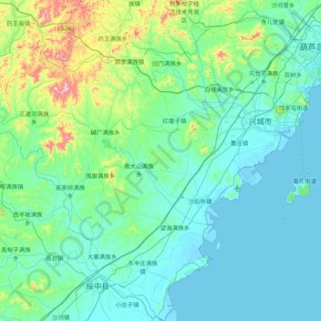
Name: 兴城市 topographic map, elevation, terrain.
Location: 兴城市, 葫芦岛市, 辽宁省, 中国 (40.26646 120.09612 40.83211 120.82744)
Average elevation: 87 m
Minimum elevation: -1 m
Maximum elevation: 657 m
Other topographic maps
Click on a map to view its topography, its elevation and its terrain.