
Mammoth Lakes topographic map
Interactive map
Click on the map to display elevation.
About this map
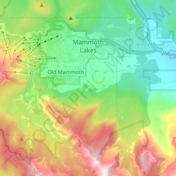
Name: Mammoth Lakes topographic map, elevation, terrain.
Location: Mammoth Lakes, Mono County, Californie, États-Unis (37.58012 -119.06137 37.65947 -118.93701)
Average elevation: 2,687 m
Minimum elevation: 2,195 m
Maximum elevation: 3,569 m