Geolocate

Utrecht topographic map

Click on the map to display elevation.

About this map

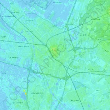
Name: Utrecht topographic map, elevation, terrain.

Location: Utrecht, Netherlands (52.02628 4.97010 52.14205 5.19516)

Average elevation: 3 m

Minimum elevation: -5 m

Maximum elevation: 20 m

Other topographic maps

Click on a map to view its topography, its elevation and its terrain.

Palestina

Netherlands > Utrecht > Amersfoort

Average elevation: 2 m

Cabauw

Netherlands > Utrecht

Average elevation: -1 m

Amerongse Berg

Netherlands > Utrecht > Amerongen

Average elevation: 34 m

Breedeveen

Netherlands > Utrecht > Leersum

Average elevation: 15 m

Eembrugge

Netherlands > Utrecht > Baarn

Average elevation: 1 m

Graaf

Netherlands > Utrecht > Lopik

Average elevation: 0 m

Gear up for your next adventure:

🔦LED Camping Lanterns - Illumination for reading maps inside your tent at night
🥾Women's Waterproof Hiking Boots - High-performance trekking boots designed for all-weather comfort
🔋Power Banks - Portable chargers for long outdoor trips
🧺Ultralight Dry Bags - Organize and waterproof your gear inside your rucksack
🧢Hiking Hats - Sun and weather protection for outdoor walks

As an Amazon Associate, this site earns from qualifying purchases at no extra cost to you.