
Marston Moor topographic map
Interactive map
Click on the map to display elevation.
About this map
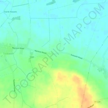
Name: Marston Moor topographic map, elevation, terrain.
Average elevation: 24 m
Minimum elevation: 12 m
Maximum elevation: 45 m
Other topographic maps
Click on a map to view its topography, its elevation and its terrain.
Angram
United Kingdom > England > North Yorkshire > Harrogate > Long Marston
Angram, Long Marston, Harrogate, North Yorkshire, England, YO23 3PA, United Kingdom
Average elevation: 23 m
Long Marston
United Kingdom > England > North Yorkshire > Harrogate > Long Marston
Long Marston, Harrogate, North Yorkshire, Yorkshire and the Humber, England, United Kingdom
Average elevation: 22 m