
Thank you for supporting this site ❤️
Make a donation
Make a donation
Gear up for your next adventure:
As an Amazon Associate, this site earns from qualifying purchases at no extra cost to you.
Ngari topographic map
Click on the map to display elevation.
Thank you for supporting this site ❤️
Make a donation
Make a donation
Gear up for your next adventure:
As an Amazon Associate, this site earns from qualifying purchases at no extra cost to you.
About this map
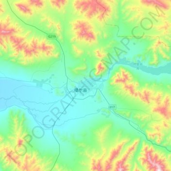
Name: Ngari topographic map, elevation, terrain.
Location: Ngari, Shiquanhe, Gar County, Ngari Prefecture, Tibet, China (31.50243 79.10561 33.50243 81.10561)
Average elevation: 4,918 m
Minimum elevation: 3,518 m
Maximum elevation: 6,644 m
Thank you for supporting this site ❤️
Make a donation
Make a donation
Gear up for your next adventure:
As an Amazon Associate, this site earns from qualifying purchases at no extra cost to you.