
Thank you for supporting this site ❤️
Make a donation
Make a donation
Gear up for your next adventure:
As an Amazon Associate, this site earns from qualifying purchases at no extra cost to you.
Bhaktapur topographic map
Click on the map to display elevation.
Thank you for supporting this site ❤️
Make a donation
Make a donation
Gear up for your next adventure:
As an Amazon Associate, this site earns from qualifying purchases at no extra cost to you.
About this map
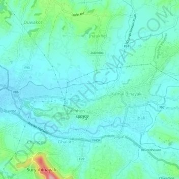
Name: Bhaktapur topographic map, elevation, terrain.
Location: Bhaktapur, Bagmati, Central Development Region, Nepal (27.66404 85.39987 27.69155 85.44883)
Average elevation: 1,338 m
Minimum elevation: 1,304 m
Maximum elevation: 1,498 m
Thank you for supporting this site ❤️
Make a donation
Make a donation
Gear up for your next adventure:
As an Amazon Associate, this site earns from qualifying purchases at no extra cost to you.