
Thank you for supporting this site ❤️
Make a donation
Make a donation
Gear up for your next adventure:
As an Amazon Associate, this site earns from qualifying purchases at no extra cost to you.
Loroñe topographic map
Click on the map to display elevation.
Thank you for supporting this site ❤️
Make a donation
Make a donation
Gear up for your next adventure:
As an Amazon Associate, this site earns from qualifying purchases at no extra cost to you.
About this map
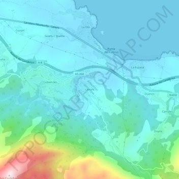
Name: Loroñe topographic map, elevation, terrain.
Location: Loroñe, Gobiendes, Colunga, Asturias, 33342, España (43.44778 -5.24607 43.48778 -5.20607)
Average elevation: 107 m
Minimum elevation: 0 m
Maximum elevation: 678 m
Thank you for supporting this site ❤️
Make a donation
Make a donation
Gear up for your next adventure:
As an Amazon Associate, this site earns from qualifying purchases at no extra cost to you.