
Caldicot topographic map
Interactive map
Click on the map to display elevation.
About this map
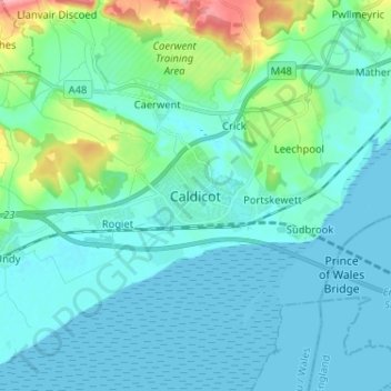
Name: Caldicot topographic map, elevation, terrain.
Location: Caldicot, Monmouthshire, Wales, NP26 4BW, United Kingdom (51.55125 -2.79176 51.63125 -2.71176)
Average elevation: 21 m
Minimum elevation: 0 m
Maximum elevation: 134 m
Monmouthshire trails, hiking, mountain biking, running and outdoor activities
Other topographic maps
Click on a map to view its topography, its elevation and its terrain.