
Thank you for supporting this site ❤️
Make a donation
Make a donation
Gear up for your next adventure:
As an Amazon Associate, this site earns from qualifying purchases at no extra cost to you.
Una topographic map
Click on the map to display elevation.
Thank you for supporting this site ❤️
Make a donation
Make a donation
Gear up for your next adventure:
As an Amazon Associate, this site earns from qualifying purchases at no extra cost to you.
About this map
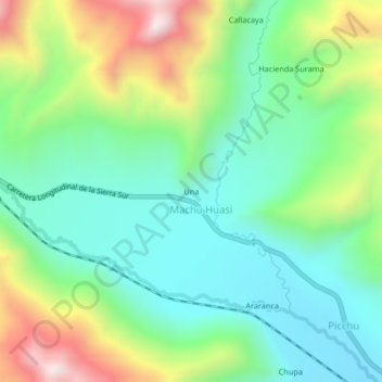
Name: Una topographic map, elevation, terrain.
Location: Una, Machu Huasi, Santa Rosa, Melgar, Puno, Perú (-14.51540 -70.96117 -14.47540 -70.92117)
Average elevation: 4,365 m
Minimum elevation: 4,110 m
Maximum elevation: 4,899 m
Thank you for supporting this site ❤️
Make a donation
Make a donation
Gear up for your next adventure:
As an Amazon Associate, this site earns from qualifying purchases at no extra cost to you.