
Thank you for supporting this site ❤️
Make a donation
Make a donation
Gear up for your next adventure:
As an Amazon Associate, this site earns from qualifying purchases at no extra cost to you.
Siwan topographic map
Click on the map to display elevation.
Thank you for supporting this site ❤️
Make a donation
Make a donation
Gear up for your next adventure:
As an Amazon Associate, this site earns from qualifying purchases at no extra cost to you.
About this map
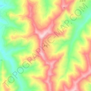
Name: Siwan topographic map, elevation, terrain.
Location: Siwan, Anding District, Dingxi City, Gansu, China (35.51860 104.82200 35.55860 104.86200)
Average elevation: 2,067 m
Minimum elevation: 1,892 m
Maximum elevation: 2,224 m
Thank you for supporting this site ❤️
Make a donation
Make a donation
Gear up for your next adventure:
As an Amazon Associate, this site earns from qualifying purchases at no extra cost to you.