
Bergerie de Ballone topographic map
Interactive map
Click on the map to display elevation.
About this map
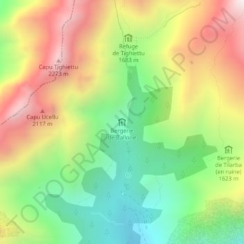
Name: Bergerie de Ballone topographic map, elevation, terrain.
Average elevation: 1,711 m
Minimum elevation: 1,226 m
Maximum elevation: 2,304 m
Other topographic maps
Click on a map to view its topography, its elevation and its terrain.
Albertacce
Francia > Córcega > Alta Córcega > Albertacce > Albertacce
Albertacce, Corte, Alta Córcega, Córcega, Francia metropolitana, 20224, Francia
Average elevation: 996 m