
Narayangaon topographic map
Interactive map
Click on the map to display elevation.
About this map
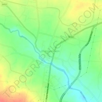
Name: Narayangaon topographic map, elevation, terrain.
Location: Narayangaon, Junnar, Pune District, Maharashtra, 410504, India (19.10029 73.95329 19.14029 73.99329)
Average elevation: 664 m
Minimum elevation: 639 m
Maximum elevation: 698 m