
Kühtai topographic map
Interactive map
Click on the map to display elevation.
About this map
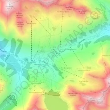
Name: Kühtai topographic map, elevation, terrain.
Location: Kühtai, Silz, Bezirk Imst, 6183, Austria (47.19362 11.00340 47.23362 11.04340)
Average elevation: 2,265 m
Minimum elevation: 1,826 m
Maximum elevation: 2,807 m
Other topographic maps
Click on a map to view its topography, its elevation and its terrain.
Habichen
Austria > Bezirk Imst > Oetz
Habichen, Oetz, Bezirk Imst, 6433, Austria
Average elevation: 1,305 m
Habicher See
Austria > Bezirk Imst > Oetz > Habichen
Habicher See, Habichen, Oetz, Bezirk Imst, 6433, Austria
Average elevation: 1,148 m
Obergurgl
Austria > Bezirk Imst > Sölden
Obergurgl, Sölden, Bezirk Imst, 6456, Austria
Average elevation: 2,324 m