
Hunga topographic map
Interactive map
Click on the map to display elevation.
About this map
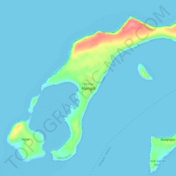
Name: Hunga topographic map, elevation, terrain.
Location: Hunga, Vahe Motu, Vavaʻu, Tonga (-18.70801 -174.13368 -18.66828 -174.08314)
Average elevation: 8 m
Minimum elevation: 0 m
Maximum elevation: 84 m
Other topographic maps
Click on a map to view its topography, its elevation and its terrain.