
Elmore City topographic map
Interactive map
Click on the map to display elevation.
About this map
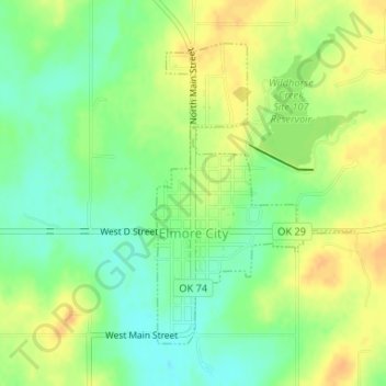
Name: Elmore City topographic map, elevation, terrain.
Location: Elmore City, Garvin County, Oklahoma, United States (34.61508 -97.39962 34.63611 -97.38269)
Average elevation: 302 m
Minimum elevation: 285 m
Maximum elevation: 317 m
Other topographic maps
Click on a map to view its topography, its elevation and its terrain.
Katie
United States > Oklahoma > Garvin County > Katie
Katie, Garvin County, Oklahoma, United States
Average elevation: 291 m