
Podmolnik topographic map
Interactive map
Click on the map to display elevation.
About this map
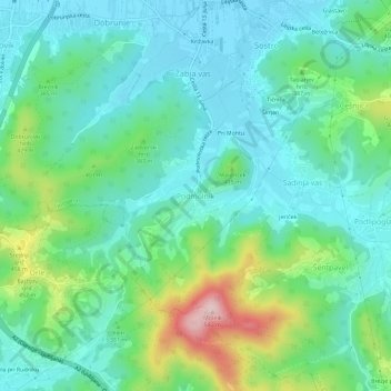
Name: Podmolnik topographic map, elevation, terrain.
Location: Podmolnik, Ljubljana, Upravna Enota Ljubljana, 1261, Slovenia (46.00006 14.57661 46.04006 14.61661)
Average elevation: 352 m
Minimum elevation: 277 m
Maximum elevation: 574 m
Other topographic maps
Click on a map to view its topography, its elevation and its terrain.