
Lumby topographic map
Interactive map
Click on the map to display elevation.
About this map
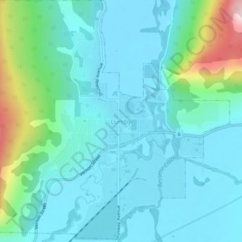
Name: Lumby topographic map, elevation, terrain.
Average elevation: 556 m
Minimum elevation: 487 m
Maximum elevation: 865 m
Other topographic maps
Click on a map to view its topography, its elevation and its terrain.
Vernon
Kanada > Britisch-Kolumbien > Regional District of North Okanagan > Vernon
Vernon, Regional District of North Okanagan, Britisch-Kolumbien, Kanada
Average elevation: 681 m