Geolocate

Mears topographic map

Click on the map to display elevation.

About this map

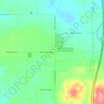
Name: Mears topographic map, elevation, terrain.

Location: Mears, Golden Township, Oceana County, Michigan, United States (43.66195 -86.43980 43.70195 -86.39980)

Average elevation: 235 m

Minimum elevation: 202 m

Maximum elevation: 310 m

Other topographic maps

Click on a map to view its topography, its elevation and its terrain.

Hart

United States > Michigan > Oceana County

Average elevation: 215 m

Benona Township

United States > Michigan > Oceana County

Average elevation: 216 m

New Era

United States > Michigan > Oceana County

Average elevation: 243 m

Shelby Township

United States > Michigan > Oceana County

Average elevation: 261 m

Otto Township

United States > Michigan > Oceana County

Average elevation: 210 m

Gear up for your next adventure:

👖Hiking Trousers - Durable trousers designed for rough terrain
📕Outdoor Navigation Books - Learn traditional and modern navigation techniques
📷Camera Straps - Secure straps for carrying cameras while walking
🧤Waterproof Overmitts - Extreme weather protection for hikers and mountaineers
🧥Breathable Waterproof Jackets - Essential rain protection for the unpredictable British climate

As an Amazon Associate, this site earns from qualifying purchases at no extra cost to you.