
El Quemado topographic map
Interactive map
Click on the map to display elevation.
About this map
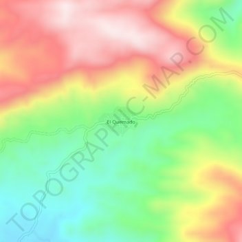
Name: El Quemado topographic map, elevation, terrain.
Location: El Quemado, Atoyac de Álvarez, Guerrero, México (17.17361 -100.30972 17.21361 -100.26972)
Average elevation: 686 m
Minimum elevation: 443 m
Maximum elevation: 956 m
Other topographic maps
Click on a map to view its topography, its elevation and its terrain.
Corral Falso
México > Guerrero > Atoyac de Álvarez
Corral Falso, Atoyac de Álvarez, Guerrero, México
Average elevation: 24 m