
Spencer County topographic map
Interactive map
Click on the map to display elevation.
About this map
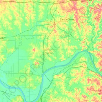
Name: Spencer County topographic map, elevation, terrain.
Location: Spencer County, Indiana, United States (37.78251 -87.26900 38.20515 -86.76497)
Average elevation: 134 m
Minimum elevation: 107 m
Maximum elevation: 209 m
Other topographic maps
Click on a map to view its topography, its elevation and its terrain.
Saint Meinrad
United States > Indiana > Spencer County > Saint Meinrad
Saint Meinrad, Spencer County, Indiana, United States
Average elevation: 148 m