
Thank you for supporting this site ❤️
Make a donation
Make a donation
Gear up for your next adventure:
As an Amazon Associate, this site earns from qualifying purchases at no extra cost to you.
Kume topographic map
Click on the map to display elevation.
Thank you for supporting this site ❤️
Make a donation
Make a donation
Gear up for your next adventure:
As an Amazon Associate, this site earns from qualifying purchases at no extra cost to you.
About this map
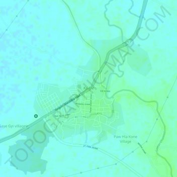
Name: Kume topographic map, elevation, terrain.
Location: Kume, Myittha Township, Kyaukse District, Mandalay, Myanmar (21.35286 96.15346 21.36921 96.17299)
Average elevation: 101 m
Minimum elevation: 97 m
Maximum elevation: 106 m
Thank you for supporting this site ❤️
Make a donation
Make a donation
Gear up for your next adventure:
As an Amazon Associate, this site earns from qualifying purchases at no extra cost to you.
Other topographic maps
Click on a map to view its topography, its elevation and its terrain.
Zay Kone စျေးကုန်း
Myanmar > Mandalay > Kyaukse District > Myittha Township > Zay Kone စျေးကုန်း
Average elevation: 100 m