Geolocate

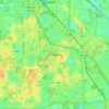
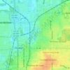
Ocala Ridge topographic map

Click on the map to display elevation.

About this map

Name: Ocala Ridge topographic map, elevation, terrain.

Location: Ocala Ridge, Marion County, Florida, 37775, United States (29.17331 -82.23371 29.21331 -82.19371)

Average elevation: 27 m

Minimum elevation: 17 m

Maximum elevation: 35 m

Other topographic maps

Click on a map to view its topography, its elevation and its terrain.
Ocala

United States > Florida > Marion County

Ocala features a varied terrain of rolling hills, gently undulating plains, and rich limestone formations typical of north-central Florida. The area rests at an elevation that generally ranges from around 50 to 150 feet above sea level, with pockets of higher ground providing scenic overlooks and natural…

Average elevation: 28 m
Lake Kerr

United States > Florida > Marion County > Salt Springs

Average elevation: 19 m

Belleview

United States > Florida > Marion County

Average elevation: 29 m

Dunnellon

United States > Florida > Marion County

Average elevation: 21 m

Reddick

United States > Florida > Marion County

Average elevation: 33 m

Ocala

United States > Florida > Marion County

Average elevation: 28 m

Ocala

United States > Florida > Marion County

Average elevation: 28 m

Belleview

United States > Florida > Marion County

Average elevation: 29 m

Lake Tuscawilla

United States > Florida > Marion County > Ocala

Average elevation: 31 m

Gear up for your next adventure:

🔋Rechargeable Batteries - Eco-friendly power for headlamps and older GPS units
🍲Portable Camping Stoves - Fast-boiling stoves for hot meals on remote topographic survey trips
🥾Trekking Poles - Poles to improve stability on uneven terrain
🥾Hiking Boot Waterproofing Wax - Maintain the lifespan of your leather trekking boots
🧊Insulated Flasks - Keeps drinks hot or cold during hikes

As an Amazon Associate, this site earns from qualifying purchases at no extra cost to you.