Geolocate

Lopez topographic map

Click on the map to display elevation.

About this map

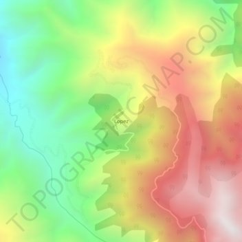
Name: Lopez topographic map, elevation, terrain.

Location: Lopez, Toribío, Norte, Cauca, RAP Pacífico, Colombia (2.96380 -76.17036 3.00380 -76.13036)

Average elevation: 3,087 m

Minimum elevation: 2,370 m

Maximum elevation: 3,890 m

Gear up for your next adventure:

🔥Reusable Hand Warmers - Maintain dexterity in your fingers for precise map handling
🩹Hiking First Aid Kits - Compact medical kits tailored for trail injuries and emergencies
🔥Emergency Fire Starters - Reliable ignition tools for survival situations in damp conditions
🔪Outdoor Multi-Tools - Versatile tools for gear repairs and food prep in the wild
🧭Emergency Beacons - Safety beacons for remote outdoor locations

As an Amazon Associate, this site earns from qualifying purchases at no extra cost to you.