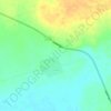
Murzuq topographic map
Click on the map to display elevation.
About this map

Name: Murzuq topographic map, elevation, terrain.
Location: Murzuq, Libya (25.75409 13.75972 26.07409 14.07972)
Average elevation: 460 m
Minimum elevation: 437 m
Maximum elevation: 534 m
Other topographic maps
Click on a map to view its topography, its elevation and its terrain.

Waw an Namus
Also within the caldera are three small lakes and additional smaller water bodies, which together form a semicircle around the northern, eastern and southern flanks of the central cone. One of the lakes is north of the scoria cone, the second southeast and south and the third southwest. These lakes cover a…
Average elevation: 439 m