
Kariara ward topographic map
Interactive map
Click on the map to display elevation.
About this map
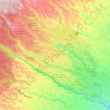
Name: Kariara ward topographic map, elevation, terrain.
Location: Kariara ward, Murang'a County, Central Kenya, Kenya (-0.89954 36.78111 -0.78520 36.88864)
Average elevation: 2,038 m
Minimum elevation: 1,737 m
Maximum elevation: 2,325 m
Other topographic maps
Click on a map to view its topography, its elevation and its terrain.