Geolocate

Bagley topographic map

Interactive map

Click on the map to display elevation.

About this map

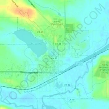
Name: Bagley topographic map, elevation, terrain.

Location: Bagley, Clearwater County, Minnesota, 56621, United States (47.51482 -95.42602 47.53837 -95.38319)

Average elevation: 445 m

Minimum elevation: 436 m

Maximum elevation: 469 m

Other topographic maps

Click on a map to view its topography, its elevation and its terrain.

Lake Itasca

United States > Minnesota > Clearwater County

Lake Itasca, Clearwater County, Minnesota, United States

Average elevation: 463 m

Leonard

United States > Minnesota > Clearwater County > Leonard

Leonard, Clearwater County, Minnesota, United States

Average elevation: 440 m

Clearbrook

United States > Minnesota > Clearwater County

Clearbrook, Clearwater County, Minnesota, 56634, United States

Average elevation: 410 m