
Gwangjin-gu topographic map
Interactive map
Click on the map to display elevation.
About this map
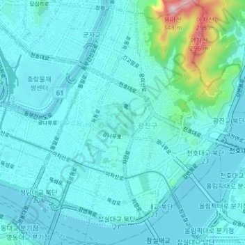
Name: Gwangjin-gu topographic map, elevation, terrain.
Location: Gwangjin-gu, Seoul, South Korea (37.52277 127.05720 37.57343 127.11517)
Average elevation: 40 m
Minimum elevation: 3 m
Maximum elevation: 327 m
Other topographic maps
Click on a map to view its topography, its elevation and its terrain.