
Jonesboro topographic map
Interactive map
Click on the map to display elevation.
About this map
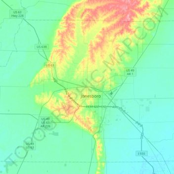
Name: Jonesboro topographic map, elevation, terrain.
Location: Jonesboro, Craighead County, Arkansas, 72401, United States (35.68286 -90.86345 36.00286 -90.54345)
Average elevation: 87 m
Minimum elevation: 66 m
Maximum elevation: 160 m
Other topographic maps
Click on a map to view its topography, its elevation and its terrain.
Jonesboro
United States > Arkansas > Craighead County > Jonesboro
Jonesboro, Craighead County, Arkansas, United States
Average elevation: 90 m