Geolocate

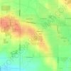
Aldergrove topographic map

Click on the map to display elevation.

About this map

Name: Aldergrove topographic map, elevation, terrain.

Location: Aldergrove, Township of Langley, Metro Vancouver Regional District, British Columbia, Canada (49.04569 -122.50378 49.06770 -122.45964)

Average elevation: 107 m

Minimum elevation: 82 m

Maximum elevation: 135 m

Other topographic maps

Click on a map to view its topography, its elevation and its terrain.
Gear up for your next adventure:

☕Insulated Travel Mugs - Keep drinks hot while surveying the landscape from a summit
👟Women's Trail Running Shoes - Agile footwear for fell running and technical trails
📦Dry Bags - Waterproof bags to protect gear from rain
🐕Dog Hiking Gear - Equipment for hiking safely with dogs
🔋Rechargeable Batteries - Eco-friendly power for headlamps and older GPS units

As an Amazon Associate, this site earns from qualifying purchases at no extra cost to you.