
Weiler-la-Tour topographic map
Interactive map
Click on the map to display elevation.
About this map
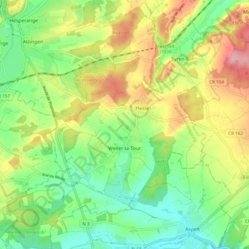
Name: Weiler-la-Tour topographic map, elevation, terrain.
Location: Weiler-la-Tour, Canton Luxembourg, Luxembourg (49.51698 6.15541 49.57778 6.23548)
Average elevation: 284 m
Minimum elevation: 231 m
Maximum elevation: 359 m