
Kingston St. Mary topographic map
Interactive map
Click on the map to display elevation.
About this map
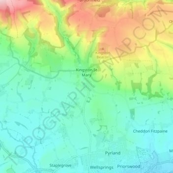
Name: Kingston St. Mary topographic map, elevation, terrain.
Average elevation: 92 m
Minimum elevation: 13 m
Maximum elevation: 280 m
Other topographic maps
Click on a map to view its topography, its elevation and its terrain.
Nailsbourne
United Kingdom > England > Somerset > Somerset West and Taunton > Kingston St. Mary > Nailsbourne
Nailsbourne, Kingston St. Mary, Somerset West and Taunton, Somerset, South West England, England, TA2 8AG, United Kingdom
Average elevation: 66 m