
Tichy topographic map
Interactive map
Click on the map to display elevation.
About this map
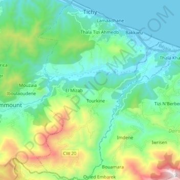
Name: Tichy topographic map, elevation, terrain.
Location: Tichy, Tichy District, Bejaia, 06023, Algeria (36.56556 5.11646 36.67608 5.21315)
Average elevation: 410 m
Minimum elevation: -1 m
Maximum elevation: 1,728 m