
Luggate Burn topographic map
Interactive map
Click on the map to display elevation.
About this map
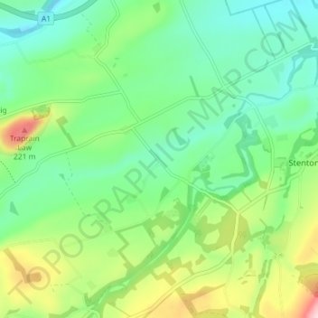
Name: Luggate Burn topographic map, elevation, terrain.
Location: Luggate Burn, East Lothian, Scotland, EH41 4QA, United Kingdom (55.93959 -2.66133 55.97959 -2.62133)
Average elevation: 96 m
Minimum elevation: 25 m
Maximum elevation: 254 m
East Lothian trails, hiking, mountain biking, running and outdoor activities
Other topographic maps
Click on a map to view its topography, its elevation and its terrain.