
Telz topographic map
Interactive map
Click on the map to display elevation.
About this map
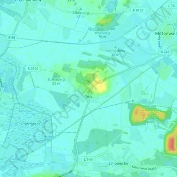
Name: Telz topographic map, elevation, terrain.
Location: Telz, Mittenwalde, Dahme-Spreewald, Brandenburg, Deutschland (52.23196 13.44974 52.26186 13.53986)
Average elevation: 40 m
Minimum elevation: 34 m
Maximum elevation: 74 m