
Pilley's Island topographic map
Interactive map
Click on the map to display elevation.
About this map
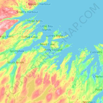
Name: Pilley's Island topographic map, elevation, terrain.
Location: Pilley's Island, Newfoundland and Labrador, Canada (49.17340 -56.06216 49.81340 -55.42216)
Average elevation: 78 m
Minimum elevation: -1 m
Maximum elevation: 408 m