
Thank you for supporting this site ❤️
Make a donation
Make a donation
Gear up for your next adventure:
As an Amazon Associate, this site earns from qualifying purchases at no extra cost to you.
Rengging topographic map
Click on the map to display elevation.
Thank you for supporting this site ❤️
Make a donation
Make a donation
Gear up for your next adventure:
As an Amazon Associate, this site earns from qualifying purchases at no extra cost to you.
About this map
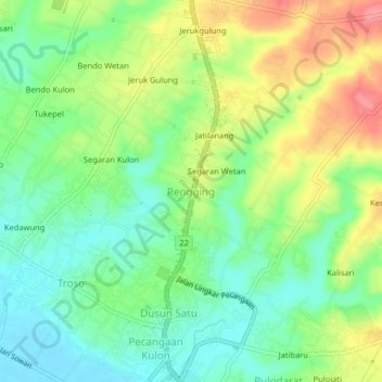
Name: Rengging topographic map, elevation, terrain.
Location: Rengging, Jepara, Central Java, Java, 59462, Indonesia (-6.69633 110.68972 -6.65633 110.72972)
Average elevation: 35 m
Minimum elevation: 2 m
Maximum elevation: 85 m
Thank you for supporting this site ❤️
Make a donation
Make a donation
Gear up for your next adventure:
As an Amazon Associate, this site earns from qualifying purchases at no extra cost to you.