
Thank you for supporting this site ❤️
Make a donation
Make a donation
Gear up for your next adventure:
As an Amazon Associate, this site earns from qualifying purchases at no extra cost to you.
Bogli topographic map
Click on the map to display elevation.
Thank you for supporting this site ❤️
Make a donation
Make a donation
Gear up for your next adventure:
As an Amazon Associate, this site earns from qualifying purchases at no extra cost to you.
About this map
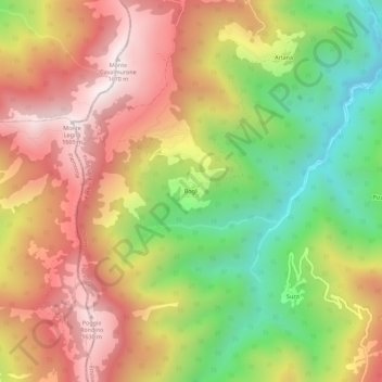
Name: Bogli topographic map, elevation, terrain.
Location: Bogli, Ottone, Piacenza, Emilia-Romagna, Italy (44.62284 9.19539 44.66284 9.23539)
Average elevation: 1,188 m
Minimum elevation: 675 m
Maximum elevation: 1,661 m
Thank you for supporting this site ❤️
Make a donation
Make a donation
Gear up for your next adventure:
As an Amazon Associate, this site earns from qualifying purchases at no extra cost to you.