
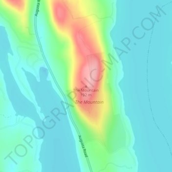
The Mountain topographic map
Interactive map
Click on the map to display elevation.
About this map
Name: The Mountain topographic map, elevation, terrain.
Location: The Mountain, Kennebec County, Maine, 04918, USA (44.55224 -69.89149 44.55234 -69.89139)
Average elevation: 99 m
Minimum elevation: 67 m
Maximum elevation: 199 m
Other topographic maps
Click on a map to view its topography, its elevation and its terrain.