
Thank you for supporting this site ❤️
Make a donation
Make a donation
Gear up for your next adventure:
As an Amazon Associate, this site earns from qualifying purchases at no extra cost to you.
9814 topographic map
Click on the map to display elevation.
Thank you for supporting this site ❤️
Make a donation
Make a donation
Gear up for your next adventure:
As an Amazon Associate, this site earns from qualifying purchases at no extra cost to you.
About this map
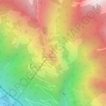
Name: 9814 topographic map, elevation, terrain.
Location: 9814, Mühldorf, Bezirk Spittal an der Drau, Carinthia, Austria (46.88442 13.34513 46.88452 13.34523)
Average elevation: 1,417 m
Minimum elevation: 603 m
Maximum elevation: 2,148 m
Thank you for supporting this site ❤️
Make a donation
Make a donation
Gear up for your next adventure:
As an Amazon Associate, this site earns from qualifying purchases at no extra cost to you.