Geolocate

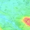
Partington topographic map

Click on the map to display elevation.

About this map

Name: Partington topographic map, elevation, terrain.

Location: Partington, Trafford, Greater Manchester, England, M31 4NL, United Kingdom (53.37767 -2.46977 53.45767 -2.38977)

Average elevation: 21 m

Minimum elevation: 6 m

Maximum elevation: 76 m

England trails, hiking, mountain biking, running and outdoor activities

Other topographic maps

Click on a map to view its topography, its elevation and its terrain.
River Mersey

United Kingdom > England > Trafford > Warburton

Average elevation: 17 m

Dunham Massey

United Kingdom > England > Trafford

Average elevation: 26 m

Partington

United Kingdom > England > Trafford

Average elevation: 19 m

Sale Water Park

United Kingdom > England > Trafford > Sale

Average elevation: 27 m

Carrington

United Kingdom > England > Trafford > Carrington

Average elevation: 20 m

Partington

United Kingdom > England > Trafford

Average elevation: 18 m

Gear up for your next adventure:

🥾Hiking Boots - Waterproof and durable boots for long-distance hiking in the UK
📷Camera Straps - Secure straps for carrying cameras while walking
🍲Portable Camping Stoves - Fast-boiling stoves for hot meals on remote topographic survey trips
🧴Sport Sunscreen Sticks - High-protection sunblock that won't run into your eyes on the trail
🚲Bikepacking Frame Bags - Storage for tools and navigation gear on long off-road rides

As an Amazon Associate, this site earns from qualifying purchases at no extra cost to you.