
Region Nordschwarzwald topographic map
Interactive map
Click on the map to display elevation.
About this map
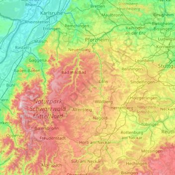
Name: Region Nordschwarzwald topographic map, elevation, terrain.
Average elevation: 445 m
Minimum elevation: 101 m
Maximum elevation: 1,162 m
Other topographic maps
Click on a map to view its topography, its elevation and its terrain.
Oststadt
Deutschland > Baden-Württemberg > Karlsruhe
Oststadt, Karlsruhe, Regierungsbezirk Karlsruhe, Baden-Württemberg, 76131, Deutschland
Average elevation: 116 m