
Konya topographic map
Click on the map to display elevation.
About this map
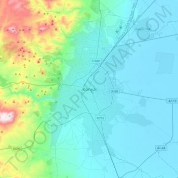
Name: Konya topographic map, elevation, terrain.
Location: Konya, Selçuklu, Konya, Central Anatolia Region, 42040, Turkey (37.71273 32.33244 38.03273 32.65244)
Average elevation: 1,160 m
Minimum elevation: 999 m
Maximum elevation: 2,052 m
Other topographic maps
Click on a map to view its topography, its elevation and its terrain.