
Woodquarter topographic map
Interactive map
Click on the map to display elevation.
About this map
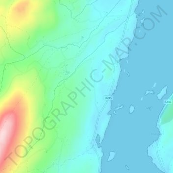
Name: Woodquarter topographic map, elevation, terrain.
Location: Woodquarter, Cranford ED, Letterkenny, County Donegal, Ireland (55.10792 -7.72965 55.13846 -7.69495)
Average elevation: 54 m
Minimum elevation: -2 m
Maximum elevation: 262 m
Other topographic maps
Click on a map to view its topography, its elevation and its terrain.