
Old Heathfield topographic map
Interactive map
Click on the map to display elevation.
About this map
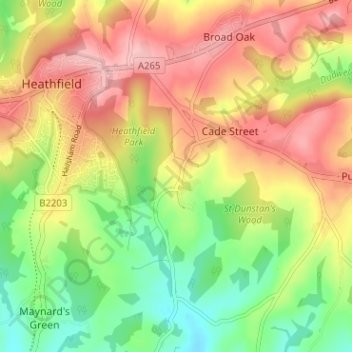
Name: Old Heathfield topographic map, elevation, terrain.
Average elevation: 119 m
Minimum elevation: 52 m
Maximum elevation: 184 m
East Sussex trails, hiking, mountain biking, running and outdoor activities
Other topographic maps
Click on a map to view its topography, its elevation and its terrain.
Heathfield Park
United Kingdom > England > East Sussex > Wealden > Cade Street
Average elevation: 132 m